Day 3
On to the Grand Canyon
Chickens Corners Trail---Lockhart Basin--Elephant Hill trail--Beef Basin into Blanding Utah
Before starting out for the few days it would take us to get to the Grand Canyon and back, we spent an entire day preparing for it. This was not a day ride---we were to spend 8 days on the trail riding from Moab to the North Rim of the Grand Canyon and back. We really didn't know how long it would take us and didn't care as we had plenty of time to enjoy ourselves with no pressure to get back any certain day or time. We packed plenty of warm clothing under our Moose gortex riding gear as we knew we could be riding in rain, snow, sleet and freezing temperatures. We also carried enough food and water for an entire day--and in an emergency---for the night. But the plan was to take a chance and end up in a motel every night. This was risky----as towns were few and far between and so were gas stations. We were kind of early on the tourist season which we hoped would help us always have a room at night. We carried emergency sleeping bags and emergency blankets----translation-----uncomfortable as hell !!!!! We had to have enough gas to go over 200 miles and this proved out to be not enough--but we lucked out. And remember the rules of offroad travel in Utah-----Have a huge gas tank---blah, blah, blah, blah etc. And never pass a gas station without filling up----never !!!! Also we were totally prepared for flats----carrying 2 tubes and all the tools necessary for changing a flat. And our bikes never let us down----thank God for electric starters-----a necessity for "Old Farts" such as us.
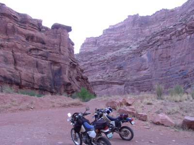
| From downtown Moab at the Mcdonalds restaurant we headed West down Kane Creek road towards Kane Creek. It turned into a neat dirt canyon road you see here. We had to cross Kane Creek shortly which can be impassable if there is high water. There is another creek (Indian Creek) on this route that can also be impassable. We took a gamble and headed on down the trail maybe getting trapped. Most people called this the Chickens Corner route. This route has a place where most people "chicken" out and turn back--or so I'm told. | |
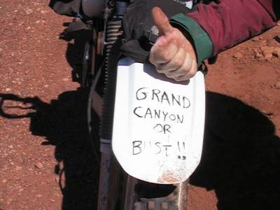
| I put this on Kenny's fender with a permanent marker just before we took off. He got a bang out of it as you can see--------a big grin of course. Sometimes on the way we thought we may have to cross out most of it and leave just "Bust" !!!!!! | |
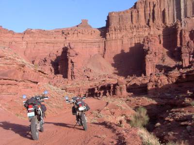
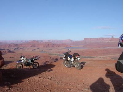
| OK------no words can describe this beauty !! Get out there and ride this now---before the stupid greenies throw us all out !!!!!!!!!! | |
| On passed this rock to "Hurrah" pass. | |
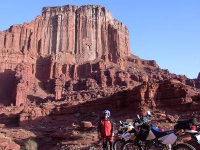
| And there is yours truly at Hurrah Pass-----a real nice pleasant scenic ride so far. | 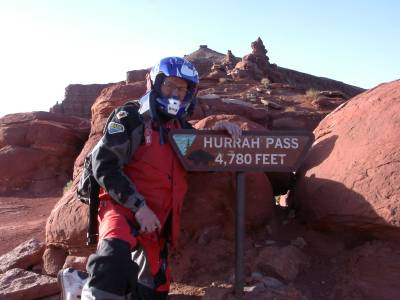 |
|
The Lockhart Basin was a very desolate area. There were no
"Services". This is about as remote a place as you can get
in the USA. A search and rescue would have to get you out of here if need
be. We were told in the summer they did an average of 2 search and rescues
around Moab everyday. We hoped to be not one of them. By the way-----cell
phones don't work out here.
We didn't take the "Chicken Corners" trail and turned South on to the Lockhart basin trail. Oh--yeah, this wasn't so easy to find. |
 |
| We were having an almost impossible day of navigating the trail in this area. There was a turn South onto the Lockhart basin trail I was warned about that you just couldn't see and would over look. We went down this trail until the riding was impossible and came back. Is this the trail ?????? | 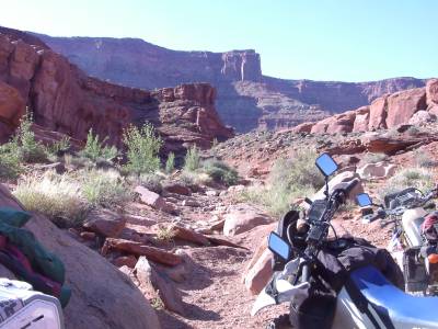 |
| Look closely----I am walking up on top of the slick rock trying to find a way thru. I finally found a way to ride my bike up there, but found it impossible to ride further and had to turn back again. Is this the trail ??? | 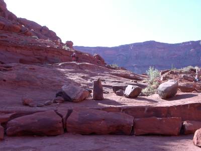 |
| This led to a dead end and we were getting frustrated and hot !!! Is this the trail ???????? | 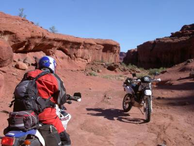 |
| This was definitely another dead end-----search and rescue where are you. Is this really the trail ????? | 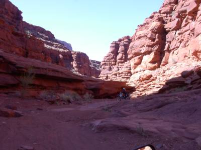 |
| After wandering around for an hour trying to find a way thru we thought our trip was going to get all screwed up right off the bat. Finally I seen a trail that went up over some slick rock that you could barely see. I almost rode on passed it after looking at it and deciding it was nothing. It was the only way thru-----and we were lucky to find it. On we went. There are so many obstacles out here that are impassable. Sometimes you can be so closed to something but can't see a way to it. Again---my GPS saved us---as it kept me informed of where I had been so I didn't just keep going around in circles----we never would have gotten thru without it. | 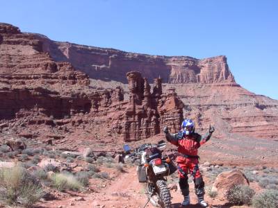 |
| Our communicators were working great and as long as a mountain wasn't in between us we could talk to each other. We finally came out to the needles district where we got gas at $2.50 per gallon and were glad to pay it. This is the only gas in this area for a hundred miles-----pay up or push !!!! |  |
| After getting gas one of the most difficult rock climbs I have attempted. This trail is called "Elephant Hill" and was a hoot. Here is Kenny on one of the easier sections---although it is much steeper and harder than it looks in the picture. | 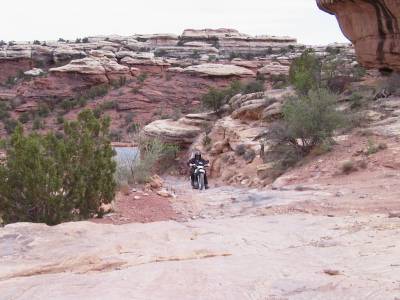 |
| After reaching the top of several rock climbs in a row, the trail flattened out somewhat into a narrow sandy trail for 30 miles or so. The sand wasn't to deep here so we enjoyed it immensely. On another day we get into sand that was a real pain and I went down a sandy, rocky hill that I couldn't get up--but I had too--you'll see what happened to me later. . | 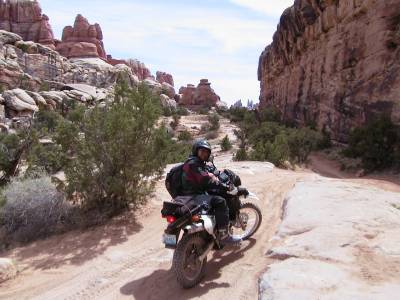 |
| Many times on the ride we would come onto a sea of aspen trees. We always stopped to admire them--they hadn't bloomed yet as it was still winter up in the higher elevations. The aspens only seemed to grow at the higher elevations---almost to the treeline (where it was so cold no trees grew at all). | 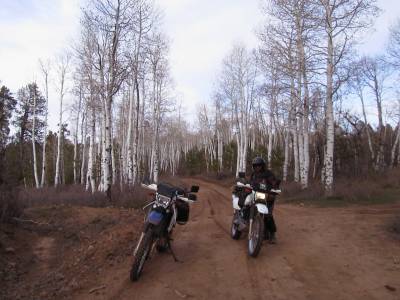 |
| This was a great trail that was pretty technical (hard) in some places---but lots of fun. | 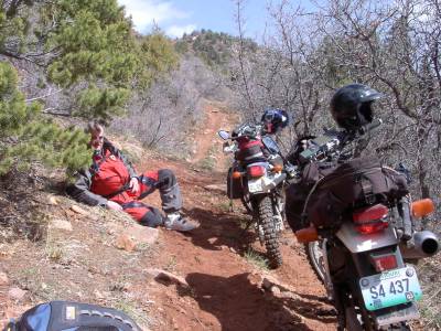 |
| This was a very high altitude (about 9,000ft.) overlook and it was very cold up here. | 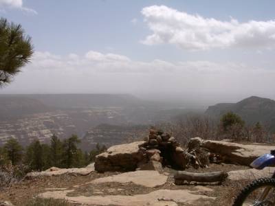 |
| I was wearing everything I had and was comfortable. I found that Land Rover hat in the mountains of Colorado-------I can't afford a land rover I'm afraid. Looks like the "Tics" brother to me. (private joke). | 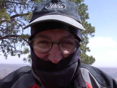 |
| We had to stop and marvel at the canyon here. This was one of the most fun trails we rode on. | 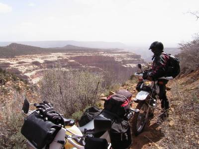 |
| It was so fun and Kenny was riding so fast he got hot and had to take some clothes off------seems he was misinformed about the riding temperature for the day. I don't know how that could have happened tho :) | 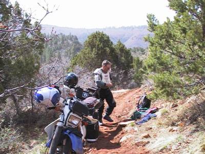 |
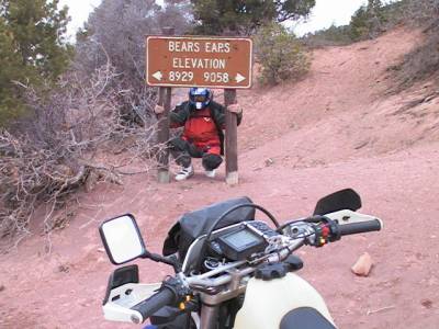
| Sign says it all. We
rode on a mountain crest that was this high and higher for 20 miles. It
was very cold (about 40°) and beautiful with pines and aspen trees everywhere. We knew
the cold wouldn't bother us unless it rained. We took advantage of the
Utah drought.
We then rode down switchback after switchback all the way to Blanding Utah where a nice warm cozy motel was there waiting for us-----with a great steak house right in the parking lot. The first day toward the Grand Canyon and about 165 miles were under our belt. I told Kenny this would be our most difficult and longest day----boy was I wrong----in fact I was wrong everyday--as Kenny jokingly reminded me of everyday. |
 |
Day Four A long Ferry ride over the Colorado River--down the "Burr Trail" and on to Escalante, Utah.